Highway 1 Pacific Coast Highway Self-Guided Driving Audio Tour
- 10–11 hours
- Free cancellation up to 24h before
- Guided in English
- Instant confirmation
Highlights
Recommended: Purchase one tour per car, not per person. Everyone listens together! Welcome to the GPS-enabled driving tour of California’s famous Highway 1, the Pacific Coast Highway! This self-guided audio tour stretches between San Francisco and Los Angeles, one of the most beautiful coastlines in the world! This self-guided audio tour allows you to explore Highway 1 with maximum flexibility and value. After booking, check your email/text to download the separate Audio Tour Guide App by Action while connected to WiFi or mobile data. Enter the password, download the tour, and enjoy it offline. Follow the audio instructions and route from the designated starting point. New, Lifetime access, no expiry. Use it anytime, on any trip, as many times as you want. The tour includes two bonus tours: Santa Monica and san Luis Obispo.
Inclusions
What's included
- Just bring your car and phone; the app guides your tour.
- Support is available via chat, email, or phone if you need help.
- Planning tools, route maps, scenic stops, and area previews included.
- Private tour experience for your family, in your own car.
- Lifetime access: use the tour anytime and keep it for future trips.
- Works offline with GPS route guidance and automatic audio stories.
- One purchase covers everyone in your car, not per person.
- Flexible tour: start, stop, and pause anytime during your trip.
- Self-guided audio tour through our easy-to-use mobile app.
- Hidden gems and local stories included along the route.
What's not
- No live guide. Entrance fees, parking, food, and car rental are separate.
Itinerary
As you drive through the town of Pacifica, you'll learn about the history of San Francisco Bay and Spanish explorer Gaspar de Portolá, who put it on the map. You'll also uncover the unusual story behind how the town got its name. NOTE: The tour is over 400 miles long, with more than 171 audio stories, and takes about 7-8 hours to complete. New, Lifetime access, no expiry. Use it anytime, on any trip, as many times as you want.
This rocky point juts out into the ocean and makes for phenomenal seaside views. There used to be a road to the point, but it's only accessible via footpath now, and only at low tide. It's a great spot for a hike with a big payoff at the end.
This bunker was built during World War II, and was intended to watch for a potential Japanese invasion of the mainland. At the time, soldiers with binoculars kept a constant watch on the horizon. These days, it's a favorite hangout spot among local youths and graffiti artists.
This beach can be an incredible place to spot whales, depending on when you visit. In December and January, gray whales migrate south past this shore. They're often close enough to see with the naked eye!
Montara is a charming, rustic town that owes its existence to an old-timey lighthouse. Many of the town's oldest buildings are still standing today, giving it a totally distinct and classic vibe.
This beach is home to some of the biggest waves around. During peak season, the swells here can reach up to 60 feet high! This makes it a super popular surfing spot for thrillseekers, though amateur surfers are probably better off watching from the shore.
This sleepy seaside town is set on the edge of a lovely crescent-shaped bay. But it has a surprisingly dark history. At one time, this area was known as the most corrupt county in California thanks to mob activity.
Bean Hollow State Beach gets its name from its oddly-shaped coast, which some swear resembles a bean. It's a humble but pleasant beach surrounded by plenty of great scenery, and makes for a great place to stop and take a quick break.
At 115 feet tall, this is the tallest lighthouse on the west coast. It's also one of the oldest. If you've been waiting for the perfect seaside photo shoot, this is a fabulous spot for it.
While you won't directly enter this park, you'll pass by its lush redwood groves as you drive. These old, enormous trees are positively awe-inspiring, and just have to be seen to be believed.
Another park you'll pass along the way, Big Basin Redwoods State Park is exactly what it sounds like. Tall old growth trees, a lush canopy, and maybe even some wildlife sightings if you're traveling in the morning!
Keep your ears open as you pass this state reserve and you just might hear its most famous residents: Elephant seals! The months between December and April are the best time to view seals here, as that's their breeding season.
Cancellation
Free cancellation up to 24 hours before the experience starts, for a full refund.
Reviews
3.6
- 58
- 49
- 32
- 22
- 14
Ratings come from 25 reviews collected by our booking partner. They are travellers' own words, in the order they were written — never reordered to flatter the experience.
Know before you go
- Meeting point
- Start at 1452 Shoreline Hwy, SF 94132, with the golf course on your right. Head south on Shoreline Hwy (Highway 1) for the scenic coastal route. This is the suggested starting point. We’re not affiliated with nearby businesses. The audio starts automatically—check your email/text for setup.
- Pickup
- Everyone meets at the starting point; there is no pickup.
- Ticket type
- Mobile or paper ticket accepted
- Operated by
- Drive with Action
- Public transportation options are available nearby
- Suitable for all physical fitness levels
- Important Note: Highway 1 (Pacific Coast Highway) is closed between Big Sur and Ragged Point due to repairs from the Regent’s Slide. This 6.8-mile stretch is impassable. For current updates, visit the Caltrans site
- As of April 16, 2025, the Overlook Trail to view McWay Falls at Julia Pfeiffer Burns State Park is closed due to a long-term retaining wall repair project. The project is expected to continue into 2026 and will also limit parking spaces within the park. At this time, the only available viewpoint for McWay Falls is a small roadside viewing area along Highway 1. The Ewoldsen Trail remains open.
- Easy to use: GPS-triggered audio plays automatically along the route for a hands-free experience.
- Private tour: Explore in your own vehicle without crowded buses or large tour groups.
- At your own pace: Start anytime and pause for hikes, picnics, photos, or scenic stops.
- Works offline: Once downloaded, the tour works using GPS without Wi-Fi or cellular service.
How it compares in Santa Monica
- Its from-price is 87% below the median of the 45 day trips we list in Santa Monica.
- It is longer than most of them.
- By number of reviews it ranks 12 of 45.
- The operator lists free cancellation on it.
About Santa Monica
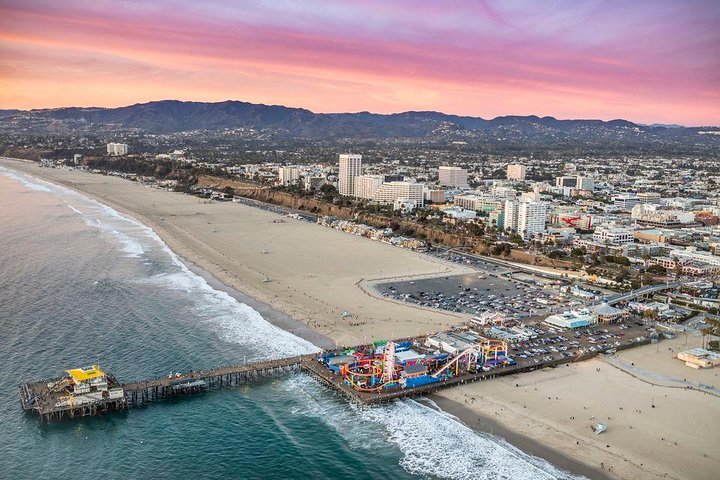
Santa Monica is a seaside city beside Los Angeles, known for its pier and Ferris wheel, wide beach, clifftop park and pedestrian shopping street.
Santa Monica sits on the Pacific coast at the western edge of Los Angeles, with a wide beach below a line of palm-topped bluffs. Its pier, built in 1909, carries a small amusement park with a solar-powered Ferris wheel, a carousel and arcades, and a sign marks the western end of Route 66. Palisades Park runs along the clifftop with ocean views.
Top-ranked sights in Santa Monica: Santa Monica Beach and Pier, Third Street Promenade, Marvin Braude Bike Trail.
Special offers in Santa Monica
Was/now prices come from the operator, never from us.