Etna - Trekking to the summit craters (only guide service) experienced hikers
- 5h 30m
- Free cancellation up to 24h before
- 3 languages
- Instant confirmation
Highlights
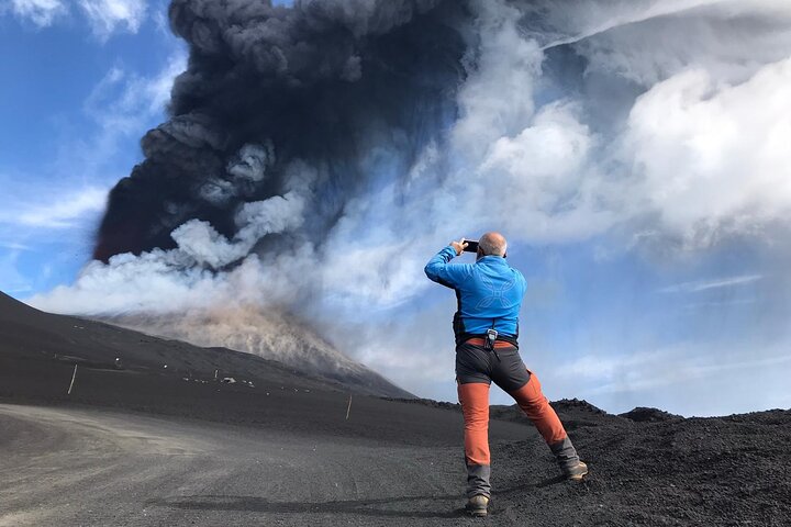
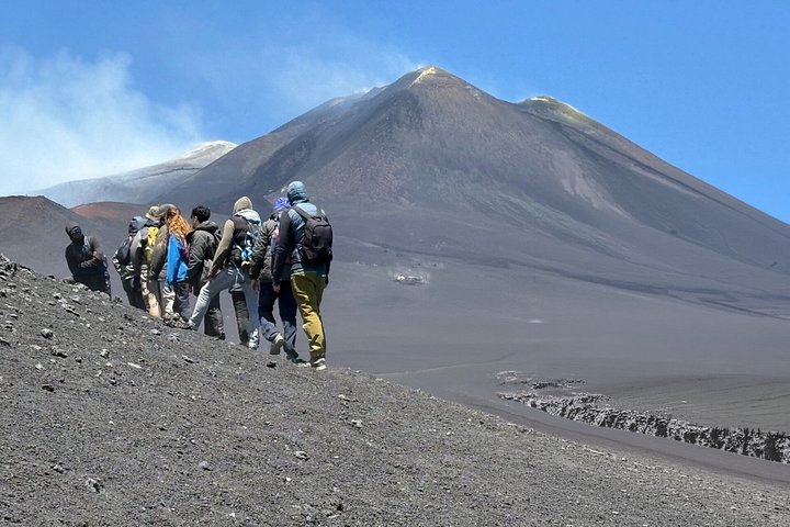
Trekking in small groups Ascent by off-road vehicles along the panoramic northern slope up to 2,825 meters. From there, the hike continues on foot through volcanic scoria and lava bombs, with a 500-meter elevation gain, reaching the rim of the Central Crater at 3,380 meters. After a stop at the summit to observe the volcanic landscape, the descent is on foot down to 1,800 meters (approx. 7 km), crossing large gullies filled with soft volcanic sand. Main data: • Total distance (round trip): 12 km • Maximum altitude: 3,380 m • Minimum altitude: 1,800 m • Ascent: +500 m • Descent: -1,580 m (the long downhill section may be more demanding than the climb) • Difficulty: Suitable only for experienced hikers Note: Participants who decide during the excursion to return by bus from 2,850 m to 1,800 m must pay €70 instead of €50.
Inclusions
What's included
- Licensed Volcano Guide
- Entry/Admission to Mount Etna
- Trekking poles, trekking shoes, helmets, warm jacket, extra socks, extra backpack
- Insurance in case of accidents
What's not
- Transport service from your accommodation
- Hat and gloves (during autumn, winter and spring)
- Parking ticket (€5 for the entire day on weekdays and €8 on Sundays and public holidays.)
- Off road vehicle (one way only) from1800m up to 2825m (50€per person to be paid on the spot)
- Those who choose to return by bus from 2,850 m to 1,800 m must pay €70 instead of €50
Itinerary
This is the Etna Nord tourist area at Piano Provenzana—less crowded than the southern slope, more authentic, and closely connected to the volcanic landscape. Here you meet the guides for your excursion. Before departure, you can use the restrooms, stop at the café for breakfast, enjoy a coffee or tea, and a pastry. Next, you’ll have a short briefing with the guides, who provide all the equipment and information needed for the hike. This meeting point lies within the 2002 lava flow. The tourist area of Piano Provenzana was destroyed by that eruption on October 27, 2002. The access road is fully drivable, so you can reach the starting point with your own vehicle. In winter, carry snow chains or use winter tires. From here you board 4×4 vehicles with the guides for a panoramic drive up the northern flank of Mount Etna. The route crosses lava fields and lateral craters, climbing to 2,960 m, where your trek to the summit begins.
Meet the guides at 7:45 a.m. at Piano Provenzana, departing 8:00–8:15 a.m. An afternoon start at 1:00 p.m. runs from May to October. Travel by authorized 4×4 vehicles along a 9.5 km panoramic track on Etna’s wild, less touristy north slope, where groups are smaller for a more personal experience. The route climbs from 1,800 m to 2,960 m, crossing forests, recent lava flows, a lava-flow channel, eruptive fractures and lateral craters over 40 m deep. Guides accompany you throughout, during both drive and hike. The unpaved road offers views of northern Sicily, the Aeolian Islands, Strait of Messina, Calabria, the Ionian and Tyrrhenian Seas, and, in rare clarity, the Madonie range, Gulf of Catania, Syracuse, Augusta, and the vast Valle del Bove. This itinerary reveals Etna’s landscapes—from green woodland and dramatic craters to the stark high-altitude desert—ending near 3,000 m, where the trek to the summit begins.
From 2,960 m, reached by authorized 4×4, begins the guided summit hike of Mount Etna. The trek climbs 5 km with 550 m ascent to the summit area and its four main craters: North-East, Voragine, Bocca Nuova, and South-East. Because activity varies daily, guides choose the safest route toward the most active yet secure crater, adjusting if gas, heat, or fractures require. Altitude ranges 2,960–3,323 m, so good fitness is essential and mild altitude effects are possible. The return is a long descent on foot from 3,300 to 1,800 m, about 7 km and 1,500 m negative gain, suited to experienced hikers with strong knees, as it can feel harder than the climb. The path follows soft scoria and sandy gullies through recent lava and the wide Piano delle Concalze, then crosses 2.5 km of ski slopes with rougher, stony ground before reaching the start. Total distance is about 12–13 km, with small route changes possible and an overall duration of roughly 6 hours.
Piano Provenzana, on Mount Etna’s north side, is easy to reach by private or rental car along fully paved public roads. Surrounded by pine forest and dramatic lava fields, the area was reshaped by the October 2002 eruption, which destroyed the original facilities and left a striking volcanic landscape of historic interest. You’ll find souvenir shops, cafés and bars for breakfast, lunch or coffee, plus spots to refill water bottles. In winter it serves as a ski resort; in summer it becomes the starting point for guided hikes and excursions. Blue-lined parking areas welcome cars and camper vans. If you’ve booked a tour, meet your volcanological guide directly on-site meeting points. Less crowded than other Etna stations, Piano Provenzana offers a quiet, authentic way to experience Europe’s highest active volcano.
Cancellation
Free cancellation up to 24 hours before the experience starts, for a full refund.
Reviews
4.9
- 5266
- 415
- 35
- 21
- 13
Ratings come from 290 reviews collected by our booking partner. They are travellers' own words, in the order they were written — never reordered to flatter the experience.
Know before you go
- Meeting point
- The meeting point is located in the parking lot near the active chairlift at Eta Nord in winter. The bar is the second house of the 4 present in the parking lot. Please note that our meeting point is the "Chiosco Bar Mareneve" not the "Chiosco Bar Etna Nord".
- Pickup
- Everyone meets at the starting point; there is no pickup.
- Ticket type
- Mobile or paper ticket accepted
- Group size
- Up to 12 travellers
- Operated by
- Guide Vulcanologiche Etna Nord
- Not recommended for travelers with spinal injuries
- Not recommended for pregnant travelers
- Not recommended for travelers with poor cardiovascular health
- Travelers should have a high level of physical fitness
- This type of itinerary, in relation to the type, is suited to people in good physical health, not suffering from particular diseases (breathing ones, or hypertension).
- The excursion could be subjected to variations at the discretion of the Guides, or it could be interrupted in case of changes of the environmental, climatic or volcanic conditions, so as to undermine the safety of the entire group.
- For the success of the excursion and for its correct carrying out, it’s good to know perfectly your health conditions and, if necessary, let the Guide know about them, in order to reduce the occurrence of any problems and to avoid any risks.
- The excursion will be carried out according to the limits established by the ordinance in force published by the competent authorities in case of volcanic explosions, the volcano guides must respect it. In this case the guides must stop where it is still safe to arrive for the safety of the entire group.
How it compares in Italy, outside the cities
- Its from-price is close to the median of the 736 day trips we list in Italy, outside the cities.
- Its length is typical for the group.
- By number of reviews it ranks 20 of 736.
- The operator lists free cancellation on it.
Special offers in Italy, outside the cities
Was/now prices come from the operator, never from us.