Historical Walking Tours in Valentia and the Skellig Region
- 3 hours
- Free cancellation up to 24h before
- Guided in English
- Instant confirmation
Highlights
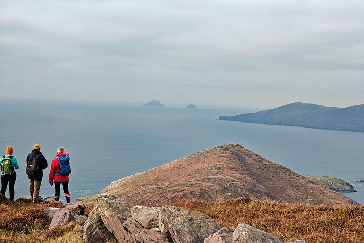
You will walk from the Car Park to the top and Bray Head and discover the history of this part of Valentia from the neolithic period to modern time. All with amazing view of the Skelligs, the Atlantic, Portmagee, and the entrance to Valentia Harbour. The walk starts in the carpark, looking onto Foilhomurrun Bay. This is where the first transatlantic cable came ashore and is also the site of a Cromwellian fort. After this you will follow the track up Bray head. Along the way you will see standing stones, ancient field enclosures, the unique ruins of Crompeol village, monastic huts with stone carvings, and finally the signal tower from the Napoleonic period. A walk through thousands of years of history in some of the most beautiful landscape in Ireland. The tour will be given by a local historian experienced in historical walks around Valentia and South Kerry, making it a unique tour.
Inclusions
What's included
- Guide
Itinerary
We will travel back in time as we walk up Bray Head and see standing stones, visit the ruined Gaelic village of Crompeol, visit the monastic huts, and look for the elaborate carvings. All while looking towards the Skelligs and over the beautiful landscape of this part of Kerry. We will also see Foilhommerum bay where the transatlantic cable first reached Valentia and Cromwell Fort, built in the 1650s.
Cancellation
Free cancellation up to 24 hours before the experience starts, for a full refund.
Reviews
5.0
- 52
- 40
- 30
- 20
- 10
Ratings come from 2 reviews collected by our booking partner. They are travellers' own words, in the order they were written — never reordered to flatter the experience.
Know before you go
- Meeting point
- We will meet you at the Bray Head Car Park 15 minutes before the start time. The guide will have a sign saying A Sense of Place. The tour will start in the car park and will last approximately 3 hours.
- Pickup
- Everyone meets at the starting point; there is no pickup.
- Ticket type
- Mobile or paper ticket accepted
- Operated by
- A Sense of Place
- Service animals allowed
- Not recommended for travelers with poor cardiovascular health
- Suitable for all physical fitness levels
- Some steep walking necessary
- Bring rain gear and good shoes or boots
How it compares in Ring of Kerry
- Its from-price is 85% below the median of the 20 experiences we list in Ring of Kerry.
- Its length is typical for the group.
- By number of reviews it ranks 13 of 20.
- The operator lists free cancellation on it.
About Ring of Kerry
The Ring of Kerry is a scenic loop around the Iveragh Peninsula in County Kerry, with Atlantic cliffs, mountain passes, lakes and ancient stone forts.
The Ring of Kerry follows the coast road around the Iveragh Peninsula for about 180 kilometres, starting and ending at Killarney, by way of Killorglin, Cahersiveen, Waterville, Sneem and Kenmare. Inland rise the MacGillycuddy's Reeks, where Carrauntoohil, at 1,038 metres, is the highest mountain in Ireland. The road alternates between sea cliffs, sandy strands and mountain passes.
Top-ranked sights in Ring of Kerry: Blasket Islands, Cahergall Stone Fort, Ballycarbery Castle.